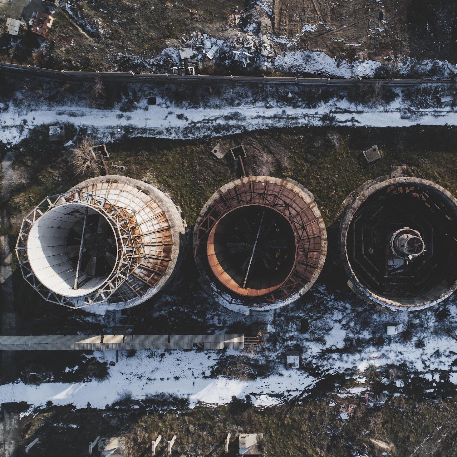
Europe has quietly become one of the most interesting places in the world for geospatial intelligence. The reasons aren’t mysterious: the EU and its member states have poured tens of billions of euros into space infrastructure over the past decade. The Copernicus Earth observation programme alone is the world’s largest open-data initiative for satellite imagery, handing out free, continuous, high-quality data that now underpins everything from climate science to commercial agriculture analytics.
But money and data aren’t the whole story. The war in Ukraine exposed how dependent Europe was on American satellite intelligence providers. That realization triggered a rush of new procurement, policy changes, and funding aimed at building homegrown GEOINT capabilities. Programs like IRIS2 (Infrastructure for Resilience, Interconnection, and Security by Satellite) and the EU Space Strategy for Security and Defence aren’t just white papers; they represent long-term bets on reducing reliance on US-based platforms.
Meanwhile, European demand for Earth observation looks different from what you’d see in the US. Regulations around sustainability reporting, carbon accounting, and environmental monitoring have created a commercial market that’s distinct from the defense-heavy American GEOINT sector. European companies are building products for precision agriculture, wildfire detection, urban heat mapping, and emissions tracking. They’re also competing globally. Here are the ones worth paying attention to.
1. LYRASENSE (UK & Germany) — The AI-Powered Geospatial Marketplace
LYRASENSE takes a different approach to geospatial intelligence. Instead of offering a single satellite constellation or a monolithic software suite, it works as an AI-powered marketplace. Users connect to multiple satellite data providers, analysis models, and deployment options through one platform. An agentic AI layer lets you describe what you need in plain language and handles the rest.
The platform pulls data across optical, SAR, thermal, and hyperspectral sources, then automates the pipeline from data sourcing through processing to insight delivery. Someone with no GIS background can stand up a monitoring application, run analytics, and deploy an operational dashboard in minutes. Not months.
The edge deployment capability is what really sets LYRASENSE apart. The platform can push AI models directly onto satellite infrastructure for on-orbit processing. That cuts latency and bandwidth costs dramatically for time-sensitive work like maritime surveillance and disaster response.
Key strengths:
- Marketplace model connecting multiple satellite data providers and AI models through a single platform
- Agentic AI interface: describe tasks in natural language, and the platform handles data sourcing, processing, and delivery automatically
- Edge deployment on satellite infrastructure for on-orbit processing
- True dual-use platform serving both defense and commercial customers
- Supports multispectral, SAR, thermal, and hyperspectral data fusion
- Backed by leading space-tech and deep-tech investors and accelerators
Considerations:
- Newer platform compared to long-established players like Airbus Intelligence or Esri
- Marketplace paradigm requires a shift in thinking for teams accustomed to monolithic GIS
- Edge deployment capabilities are expanding but not yet available across all constellation partners
Best for: Organizations that want to operationalize satellite intelligence without building a GIS team or getting locked into a single vendor’s ecosystem. Particularly strong for defense, infrastructure monitoring, emissions tracking, and agriculture.
Pricing: Subscription-based with multiple tiers. See pricing →
2. ICEYE (Finland) — The World’s Largest Commercial SAR Constellation
ICEYE operates the world’s largest commercial synthetic aperture radar (SAR) constellation: over 60 satellites delivering imagery through cloud cover, darkness, and bad weather. Their Gen4 satellites hit 16cm resolution, a number that used to be reserved for government-only systems.
The company hit profitability at roughly EUR 200M in annual revenue. That’s rare for a New Space company. On the defense side, a EUR 1.7 billion contract with Rheinmetall for the German armed forces stands as one of the largest commercial satellite deals in European defense history. It tells you where the market is heading.
Outside defense, ICEYE has built a strong business in natural catastrophe monitoring. Insurance companies and emergency responders use their near-real-time flood mapping data. Because SAR satellites can revisit the same location multiple times per day, they catch changes at a pace optical satellites can’t match.
Key strengths:
- Largest commercial SAR constellation (60+ satellites) with global coverage
- Gen4 satellites delivering 16cm resolution SAR imagery
- Proven profitability and strong revenue growth
- Major European defense contracts, including EUR 1.7B Rheinmetall partnership
- Near-real-time flood monitoring used by insurers and emergency services
Considerations:
- SAR imagery requires specialized expertise to interpret compared to optical
- Premium pricing reflects the unique all-weather, day-night capability
- Primary focus on SAR means no optical or multispectral data offering
Best for: Defense agencies, maritime surveillance, insurance companies, and disaster response organizations that need reliable, all-weather monitoring.
Pricing: Enterprise and per-area pricing; contact sales for specific use cases.
3. Airbus Intelligence (France/Germany) — Europe’s Defense Imagery Giant
Airbus Intelligence (formerly Airbus Defence and Space Intelligence) is the continent’s largest commercial satellite imagery provider and a pillar of European defense and intelligence infrastructure. The Pleiades Neo constellation delivers 30cm native resolution optical imagery, and the next generation (Pleiades Neo Next, expected around 2028) will improve resolution and revisit rates further.
Their OneAtlas platform gives cloud-based access to Airbus’s imagery archive, analytics tools, and third-party datasets. It’s the company’s answer to customers who want API-driven, digital-first workflows. Airbus has also moved into radar through the PAZ-2 collaboration with Hisdesat, adding all-weather observation to its portfolio.
Being a division of Europe’s largest aerospace company brings obvious advantages. Airbus Intelligence has deep ties to defense procurement programs across NATO and EU member states, and that institutional access is hard for any startup to replicate.
Key strengths:
- Pleiades Neo constellation delivering 30cm native resolution optical imagery
- OneAtlas cloud platform for data access, analytics, and integration
- Deep ties to European defense and intelligence communities
- Upcoming Pleiades Neo Next generation for enhanced capabilities
- PAZ-2 radar partnership expanding all-weather coverage
- Imagery archive spanning decades
Considerations:
- Enterprise-oriented procurement; less accessible for small teams and startups
- Innovation pace can lag behind agile New Space competitors
- Platform capabilities trail dedicated AI-native analytics tools
- Complex licensing and pricing structures
Best for: European defense ministries, intelligence agencies, and large enterprises that need institutional-grade imagery and long-term supplier relationships.
Pricing: Enterprise license agreements; per-image and subscription options available through OneAtlas.
4. Preligens / Safran (France) — AI-Powered Defense Intelligence
Preligens (now part of Safran’s defense electronics division after its acquisition) is one of Europe’s most specialized AI companies for defense and intelligence work. The platform uses deep learning to automatically detect and classify objects, activity patterns, and changes in satellite imagery. As the volume of available imagery grows faster than human analysts can keep up with, this kind of automation becomes a necessity, not a luxury.
The company’s algorithms are trained for military and intelligence use cases specifically: identifying aircraft types on airfields, spotting vehicle movements, monitoring naval bases, tracking construction at sensitive sites. Preligens works closely with the French Directorate of Military Intelligence (DRM) and has expanded into contracts with other European and NATO defense customers.
Key strengths:
- Purpose-built AI for defense and intelligence image analysis
- Automated detection and classification of military assets and activity
- Strong relationships with French and European defense institutions
- Now backed by Safran’s resources, R&D budget, and defense market access
- Proven operational deployment with national intelligence agencies
Considerations:
- Exclusively defense and intelligence focused; not suitable for commercial applications
- Acquisition by Safran may shift strategic priorities toward internal defense programs
- Limited publicly available information about capabilities and pricing
Best for: Defense ministries, intelligence agencies, and military organizations that need automated satellite imagery analysis for security applications.
Pricing: Government and defense contracts; not publicly disclosed.
5. European Space Imaging (Germany) — Regional Gateway for High-Resolution Imagery
European Space Imaging (EUSI) is the primary European regional partner for Maxar (now Vantor) imagery. That means access to some of the highest-resolution commercial satellite data on the market, including 30cm imagery from the WorldView Legion constellation. Based in Munich, EUSI pairs Maxar’s imagery with local expertise, European data handling practices, and regional customer support.
For European governments and organizations that need Maxar-grade imagery but prefer working through a European entity (for procurement, data sovereignty, or regulatory reasons), EUSI fills a real gap. They also offer value-added services like digital elevation models, orthorectified products, and custom processing.
Key strengths:
- Access to Maxar/Vantor’s industry-leading high-resolution satellite imagery (30cm)
- European entity for procurement and data handling compliance
- Local expertise in mapping, urban planning, and environmental monitoring
- Digital elevation models and custom geospatial products
- Long track record serving European government and commercial clients
Considerations:
- Dependent on Maxar/Vantor as the upstream data source
- Limited proprietary technology; value is in distribution and services
- Less innovation-driven than companies building their own constellations or AI platforms
Best for: European government agencies, mapping organizations, and enterprises that need high-resolution imagery with European data handling and procurement pathways.
Pricing: Per-image and subscription pricing; varies by resolution, area, and licensing terms.
6. GAF AG (Germany) — Earth Observation Services for Development and Governance
GAF AG, also based in Munich, specializes in EO-based services for governments, development agencies, and international organizations. They don’t build satellites or software platforms. Instead, they apply Earth observation data to concrete problems: land administration, agricultural monitoring, environmental assessment, and sustainable development.
The company has a long track record of project-based consulting for the European Commission, ESA, the World Bank, and national governments. Their real strength is turning raw satellite data into things policymakers can act on: land use maps, crop monitoring systems, deforestation alerts, and post-disaster assessments.
Key strengths:
- Deep domain expertise in land use monitoring, agriculture, and environmental assessment
- Strong relationships with European and international development institutions
- Project-based consulting model adaptable to diverse client needs
- Decades of experience applying EO data to governance and development challenges
- Part of the wider EO ecosystem in Munich alongside DLR and ESA/ESRIN
Considerations:
- Services-oriented business model, less scalable than platform or product companies
- Limited proprietary technology or satellite infrastructure
- Project-based revenue can be cyclical and dependent on public procurement timelines
Best for: Government agencies, international development organizations, and NGOs that need expert-driven EO analysis for land governance, agriculture, and environmental policy.
Pricing: Project-based consulting fees; varies by scope and duration.
7. Satellogic (Argentina, Growing EU Presence) — Cost-Efficient High-Frequency Imaging
Satellogic has put over 53 satellites into orbit, building one of the largest sub-meter resolution Earth observation constellations outside the established US providers. The NextGen platform delivers 30cm multispectral and hyperspectral imagery at price points designed to make frequent, high-resolution monitoring viable for a much broader set of customers.
The company is headquartered in Argentina but has been building its European presence through partnerships and customer engagements. It’s positioning itself as a cost-competitive alternative to Airbus and Maxar for European buyers. Vertical integration (Satellogic designs and manufactures its own satellites) gives it a cost structure advantage that translates directly into lower pricing.
Key strengths:
- Large constellation (53+ satellites launched) with sub-meter resolution
- NextGen platform delivering 30cm multispectral imagery
- Cost-efficient approach to high-frequency Earth observation
- Vertically integrated satellite manufacturing
- Growing partnerships and customer base in Europe
Considerations:
- Headquartered outside Europe; data sovereignty considerations for some customers
- Younger company with a less established track record than Airbus or Maxar
- Hyperspectral capabilities still maturing relative to dedicated providers
- Financial performance has faced scrutiny as a publicly traded company
Best for: Organizations looking for cost-effective, frequent satellite imagery for agriculture, infrastructure monitoring, and environmental applications.
Pricing: Per-area and subscription models designed to be more accessible than traditional providers.
8. Pixxel (India, EU Presence via ESA Partnerships) — Hyperspectral Imaging Pioneer
Pixxel is making hyperspectral imaging from space a commercial reality. The Firefly constellation of 6 satellites captures imagery across 150+ spectral bands at 5m resolution. That’s a different world from traditional multispectral satellites, which typically capture 4-8 bands. With 150+ bands, you can identify specific minerals, detect crop stress at the biochemical level, measure water quality parameters, and map industrial pollutants with a precision that multispectral data just can’t reach.
The company has built strong European ties through ESA partnerships and already serves customers across the continent. Its Aurora processing platform delivers analysis-ready data products and AI-powered analytics designed specifically for hyperspectral data.
Key strengths:
- Unique hyperspectral capability: 150+ spectral bands at 5m resolution
- Firefly constellation providing global coverage with hyperspectral data
- Mineral detection, precision agriculture, and environmental monitoring applications that are impossible with standard multispectral imagery
- Aurora platform for hyperspectral analytics and AI-powered processing
- Active ESA partnerships and growing European customer base
Considerations:
- 5m spatial resolution is lower than optical competitors, not suitable for fine-grained object identification
- Hyperspectral data requires specialized analysis expertise
- Relatively small constellation compared to optical providers
- Indian headquarters; data sovereignty may be a factor for some European defense customers
Best for: Mining companies, agricultural enterprises, environmental agencies, and researchers who need spectral analysis capabilities beyond what multispectral satellites can provide.
Pricing: Subscription and per-area models; contact sales for enterprise pricing.
9. Constellr (Germany) — Precision Thermal Intelligence for Agriculture
Constellr is going after one of the biggest gaps in commercial Earth observation: high-resolution thermal infrared imaging from space. Optical and radar satellites are plentiful. Thermal data at useful spatial and temporal resolution? Still scarce. Constellr’s microsatellite constellation is built to provide land surface temperature measurements at a resolution and revisit rate that’s actually useful for precision agriculture and water resource management at the field level.
The main use case is monitoring crop water stress and evapotranspiration, a problem that costs the global agricultural industry billions every year. Thermal signatures reveal water stress before it shows up in optical imagery. That early warning lets farmers and agricultural managers optimize irrigation, cut water waste, and protect yields.
Key strengths:
- Addressing a real gap in commercial thermal infrared Earth observation
- Precision agriculture and water stress monitoring at field-level resolution
- ESA-backed with strong support from the European institutional ecosystem
- Clear value proposition for water resource management and climate adaptation
- Munich-based with deep connections to Germany’s space and agriculture sectors
Considerations:
- Constellation is still in deployment phase; full operational coverage isn’t yet achieved
- Narrower application focus than broad-spectrum EO providers
- Thermal data interpretation requires domain expertise
- Revenue is still scaling as the constellation matures
Best for: Agricultural enterprises, irrigation districts, water management authorities, and climate adaptation organizations that need thermal data for water stress and crop health monitoring.
Pricing: Subscription-based data and analytics services; pricing scales with coverage area.
10. SatVu (UK) — High-Resolution Thermal Imaging from Space
SatVu is pushing thermal imaging resolution to a place nobody else has reached from orbit. Most thermal satellites provide data at 60-100m resolution. SatVu’s satellites deliver thermal imagery sharp enough to pick out individual buildings, industrial facilities, and infrastructure assets. That opens up applications that simply weren’t possible before from space.
Their main focus areas: monitoring industrial emissions and energy waste, assessing building energy efficiency at the urban scale, detecting methane leaks from oil and gas infrastructure, and spotting unauthorized industrial activity. Energy companies, regulators, and defense organizations have all taken notice.
Key strengths:
- Industry-leading spatial resolution for thermal imaging from space
- Unique capability to monitor industrial emissions and energy infrastructure at facility level
- Urban heat island mapping and building energy efficiency assessment
- Growing interest from energy companies, regulators, and defense customers
- UK-based with access to both European and Five Eyes markets
Considerations:
- Small constellation; coverage and revisit rates are still limited
- Thermal-only modality requires fusion with optical/radar data for full-picture analysis
- Early-stage commercial deployment with limited operational track record
- Niche capability serving specific use cases rather than broad GEOINT needs
Best for: Energy companies, environmental regulators, carbon accounting firms, and defense organizations that need thermal monitoring of industrial infrastructure.
Pricing: Enterprise and per-area pricing; contact sales for details.
11. OroraTech (Germany) — Real-Time Wildfire Detection from Space
OroraTech does one thing and does it well: detecting and monitoring wildfires from space using thermal infrared satellites. Climate change is driving longer and more destructive wildfire seasons across Southern Europe, North America, and Australia. The demand for rapid, reliable fire detection has grown fast. OroraTech is one of the few companies built from the ground up to address it.
Their constellation of thermal infrared satellites provides near-real-time wildfire alerts globally. The processing pipeline is optimized to shrink the gap between thermal detection and alert delivery to as little time as possible. The platform also integrates weather models, terrain data, and fire behavior algorithms, so it doesn’t just detect fires; it predicts risk and tracks spread.
Key strengths:
- Purpose-built thermal satellite constellation for wildfire detection
- Near-real-time global wildfire alerting system
- Integration of satellite data with weather models and fire behavior prediction
- Growing demand driven by climate change and increasing fire risk
- German/ESA-backed with strong European institutional relationships
Considerations:
- Narrow application focus, primarily wildfire detection and monitoring
- Constellation size limits revisit rate compared to larger EO providers
- Revenue model depends on scaling government and insurance contracts
- Competing with established fire monitoring systems (FIRMS, EFFIS) that use freely available data
Best for: Forestry agencies, fire departments, insurance companies, and governments in wildfire-prone regions that need rapid space-based fire detection.
Pricing: Subscription-based alerting and monitoring services; government and enterprise pricing available.
Why Europe Is Leading in GEOINT
So many GEOINT companies clustering in Europe isn’t a coincidence. Several structural factors explain it.
Copernicus as the open data backbone. The EU’s Copernicus programme gives away free, continuous satellite data through the Sentinel constellation: optical, radar, and atmospheric data at commercially useful resolutions. That open data policy has lowered the barrier to entry for startups and let companies build analytics and applications without launching their own satellites first. Nothing else at this scale exists anywhere in the world.
Digital sovereignty and strategic autonomy. The EU’s push for technological independence extends to space. Policy frameworks increasingly favor European-sourced data and analysis for government applications. That creates a protected market for domestic providers and drives investment in sovereign capabilities. The IRIS2 programme and EU Space Strategy for Security and Defence are the clearest expressions of this priority.
Strong public-private partnerships. The ESA Business Incubation Centre (BIC) network has supported dozens of EO startups across Europe with funding, technical support, and access to ESA’s data and facilities. National space agencies (DLR, CNES, UKSA, ASI) run their own programs. The European Innovation Council (EIC) and Horizon Europe provide additional funding. This layered support system helps companies get from research to revenue.
Dual-use technology frameworks. European regulations and procurement practices increasingly support companies that serve both civilian and defense markets. This dual-use approach lets companies like LYRASENSE and ICEYE build commercially viable products while meeting defense requirements, which makes for more sustainable business models than going pure-defense or pure-commercial.
Deep talent pools. Europe’s university system produces world-class graduates in remote sensing, geodesy, atmospheric science, and AI. Research and industry clusters in Munich (DLR, ESA/ESRIN, TU Munich), Toulouse (CNES, Airbus), and London (Surrey Space Centre, Imperial College) concentrate the kind of talent that feeds the broader ecosystem.
How European GEOINT Compares to US Providers
European and American GEOINT companies share many technical capabilities, but their strategic orientations differ in ways that matter.
Sustainability and climate focus. European companies are more likely to build products around environmental monitoring, climate adaptation, and sustainability reporting. That reflects EU policy priorities and commercial demand driven by regulations like the Corporate Sustainability Reporting Directive (CSRD). US providers tend to lead with defense and intelligence applications.
Data sovereignty. For European governments and organizations subject to GDPR and emerging data sovereignty frameworks, working with European providers sidesteps the jurisdictional headaches of US data handling. This factor is showing up more and more in procurement decisions.
Copernicus advantage. European companies have tighter integration with Copernicus data and the institutional ecosystem around it. US companies can access Sentinel data too, but European firms often have preferred partnerships, early access to new capabilities, and stronger relationships with the agencies running the programme.
Dual-use over defense-first. US GEOINT is shaped heavily by defense and intelligence community requirements. European companies more often operate across both civilian and defense markets from day one. The result is products that tend to be more versatile and accessible, even if they don’t match some classified-level capabilities of US counterparts.
Constellation diversity. Europe hosts a wider variety of specialized constellations: thermal (Constellr, SatVu, OroraTech), hyperspectral (Pixxel via ESA partnerships), and SAR (ICEYE), alongside traditional optical providers. That diversity creates real opportunities for data fusion and multi-modal analysis that a single-provider approach can’t replicate.
Getting Started with European GEOINT
The European GEOINT ecosystem covers just about every use case: defense intelligence, maritime surveillance, precision agriculture, climate monitoring, and more. The companies on this list represent what’s possible when public investment, open data, and commercial ambition come together in the same region.
If you’re looking for a way to access multiple European data providers, AI-powered analytics, and operational deployment through a single platform, LYRASENSE is purpose-built for that workflow. Request a demo to see how the marketplace model works in practice.
Request a demo: www.lyrasense.com Email: info@lyrasense.com


